It started with an ambitious plan to land in all lower 48 states in a 10-day time period. It ended with an epic trip from California to Maine.
“How much vacation time do you get?” was the way my friend started the phone call. He then went on to describe a plan for three of us to fly our Mooneys and land in all lower 48 states. We looked at when the best time of year would be to attempt it and put it on the calendar for early October. Then, about a month before the flight, he decided to tear apart the panel in his plane and put in a Dynon system.
Plan B
“You already have the time off, why don’t we fly to Maine and the New England area to see the fall leaves?” my wife, Kathy, suggested. This was going to be a lot of flying for her. Under the previous plan spouses were going to fly commercial to meet us in New England, join us on the flights in that area and down the East Coast, and then fly commercial back. Under this new plan Kathy would be in the Mooney for all the flights.
She had a list of places she wanted to visit along the way. I put together a rough flight plan for the trip to get an idea of how long the legs would be and general ideas for overnights, and then broke the news to her that we couldn’t make all the stops work. She pulled a couple things off the list, and then another one, and I felt we had a general idea.
It was an almost wide-open plan, mostly just general ideas about days and flights right up until the point we left. The only stop that was set was Rochester, NY. We would (hopefully) arrive by Sunday evening, spend Monday and Tuesday visiting places in the area, and depart Wednesday. I made hotel and car rental reservations with the option of cancelling 24 hours in advance. I felt fairly confident that we could make ROC unless some really bad weather cropped up. They have good approaches, and icing didn’t look like it would be a factor. Those were the only reservations we made for the trip.
For most of the trip I didn’t even plan out the stops until either the night before or the morning of the flights, and even then there were multiple changes either during a fuel stop or en route.
Day 1 – A Jumpstart After Work
Friday, October 9th · Fullerton, CA (FUL) → Mesa Gateway, AZ (IWA) · 382 miles · 2:21
If we were going to make Rochester by Sunday without really long days, I wanted to get a jumpstart on the trip. Mesa, AZ, is an easy flight after work, and there are no other cities until Albuquerque, which was too far for an after-work flight. I left for work with all my stuff in the truck and a plan to meet my wife at the airport. I left work at 3 p.m. for the 5-minute drive to the airport, she met me at 3:30, and we were wheels up at 4:02 p.m.
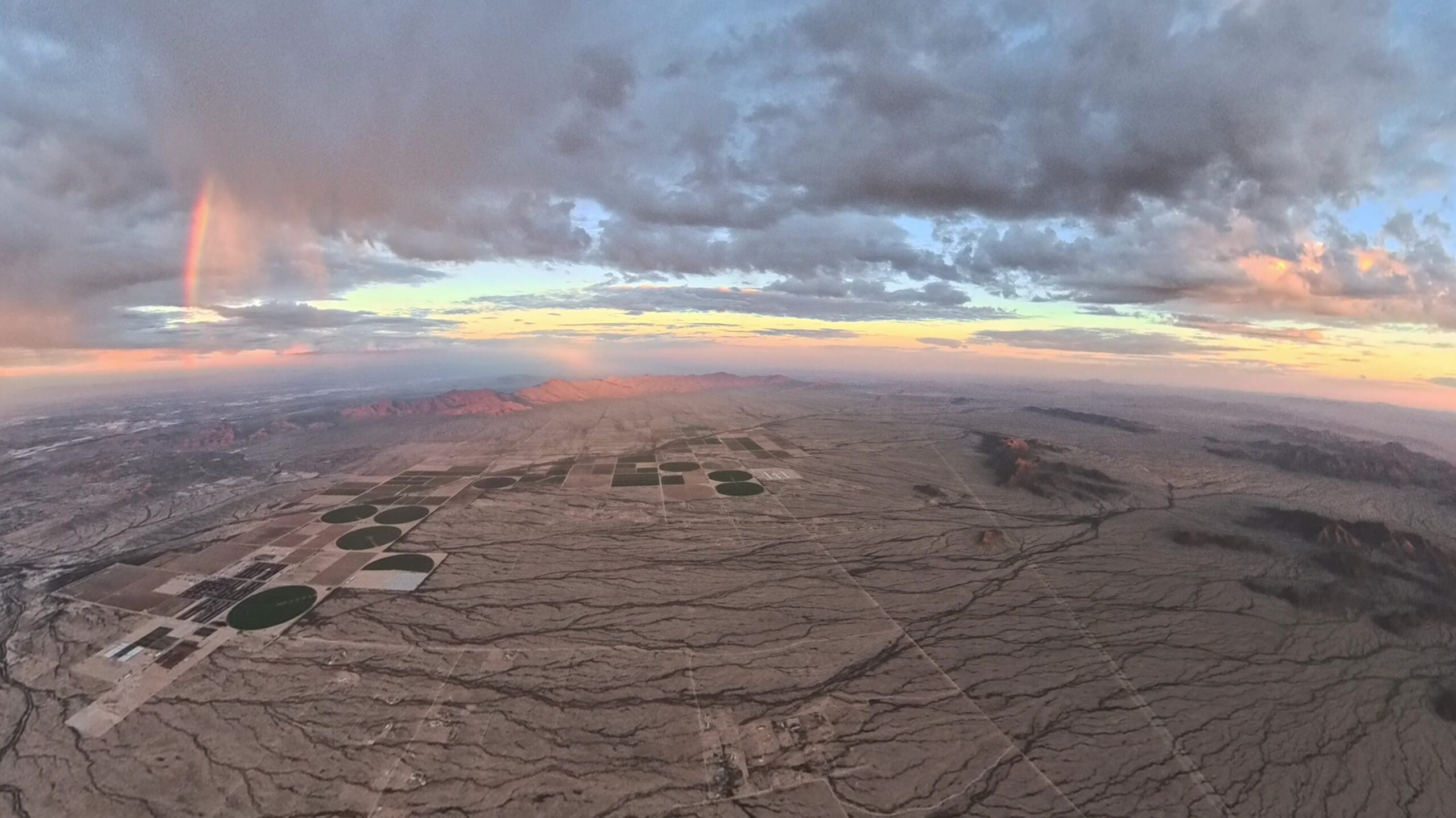
The flight was beautiful! The late sun cast shadows across the desert and lit up the patchy clouds above us. There was some virga just west of Phoenix, and as we flew past it, multiple rainbows formed and disappeared as the sun bounced off it. We flew a right downwind for 12C with a stunning sunset off our left wing and touched down at 6:23 p.m., 382 miles in 2:21. My sister met us at the airport and we had dinner there before she dropped us off at the hotel where I made a general plan for the next day.
Day 2 – Dairies, BBQ, and the Spirit of St. Louis
Saturday, October 10th · Mesa Gateway, AZ (IWA) → Dumas, TX (DUX) → Wichita, KS (AAO) → Paola, KS (K81) → St. Louis, MO (SUS) · 1,320 miles · 7:55
When I plan out a multi-leg cross-country, I like to use www.SkyVector.com on the computer. It is easy to plug in the proposed beginning and end of the day, turn on fuel prices, and then chop it up into manageable legs. I also have TFRs turned on in the layers. Stopping points for the day needed to have an airport in a big enough place where we could get an Uber, so the plan was to get to Indianapolis, IN, and leave a short day on Sunday. That didn’t happen.
We took off just after sunrise into a beautiful fall sky and climbed out over the Salt River Lakes and east over the mountains of eastern Arizona. We passed just south of Albuquerque and eventually began our descent to Moore County Airport in Dumas, TX, where we were hit with the lovely scent of the multiple dairies below. Still over 4,000 feet AGL, we were practically choking on the aroma!
The winds at pattern altitude were 39 mph and reported on the ground at 20 knots gusting 27, but almost right down the runway. It was an uneventful landing and I taxied up to the fuel pump, 587 miles in 3:29. We walked over to the pilot lounge, greeted by a friendly dog along the way, and I sat down at the table to plan the next leg. I had seen on www.fly2lunch.com that there was a great BBQ restaurant on the field at Miami County Airport in Paola, KS (K81), so I filed a flight plan, grabbed a briefing, and we were on our way.
We made an unscheduled stop at Colonel James Jabara Airport (AAO) in Wichita, KS, but eventually found ourselves at K81 looking at what we assumed was the restaurant because it was the only building there. Total of 498 miles and 2:55 flying for both legs. After getting fuel, we walked over to the building, where there was a sign on what looked like a service door for We-B-Smokin’ BBQ. We entered through a storage room (it was a service door) into a country restaurant with food worthy of the 5.0 rating on the website.
Change of Plans: St. Louis
With the unscheduled stop in Wichita, getting to Indianapolis was out of the question, so I looked for another option. We could get to St. Louis and even fly past the Arch on the way to St. Louis Regional (ALN) on the northeast side of the city. Another flight plan filed, another briefing, and with full bellies we were on our way.
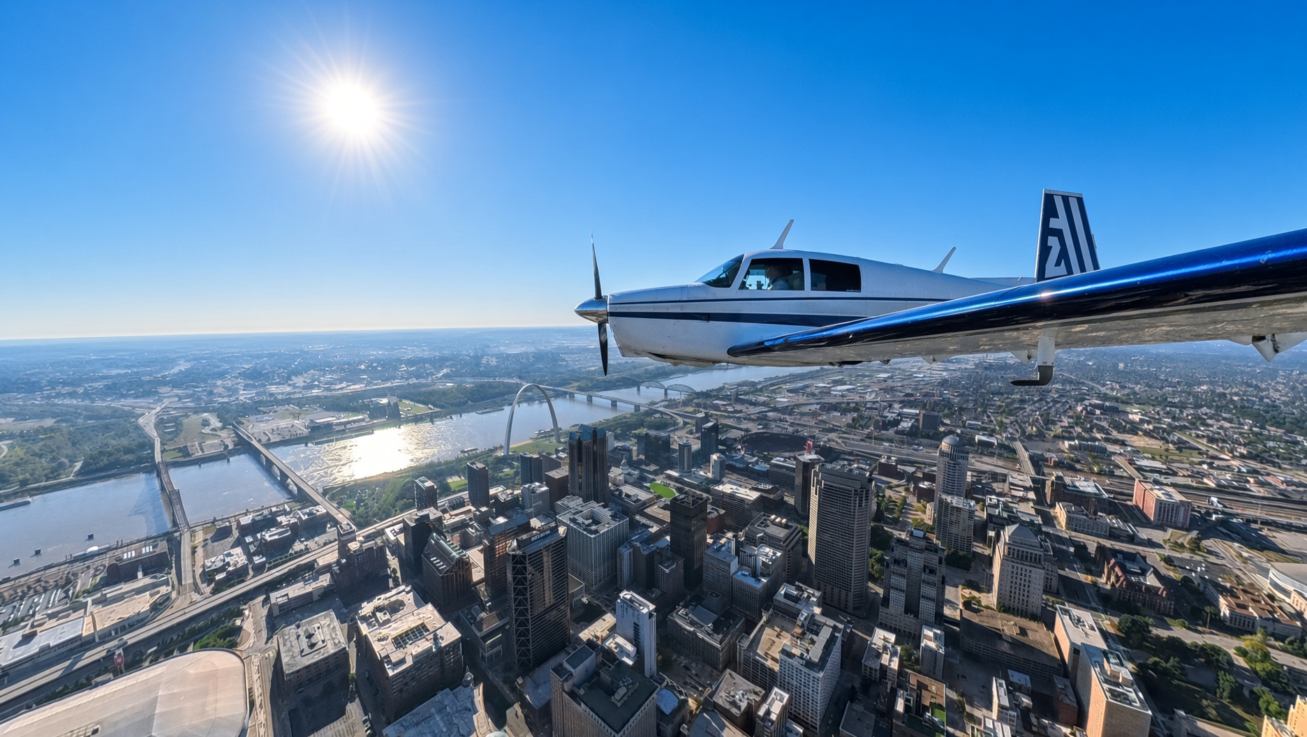
Part of the way there, I decided that flying past the Arch after sunset wasn’t going to be as nice as during the day. When I saw that the airport on the west side was the Spirit of St. Louis (SUS), that sealed the deal, and I changed the plan. Who wouldn’t want to land at an airport with that name? You’re going to notice a trend on this trip with airport names. We landed, taxied to Million Air (we’ve had good service from them in St. George), and shut down. Another 235 miles and 1:31 of flying. Inside, we asked if they had a crew car we could borrow for the night. They said yes, as long as we had it back by 9 a.m., and handed us the keys to a new Mercedes E350. A hotel search pulled up a Marriott just around the corner, so I booked a room. We were still full from We-B-Smokin’, so we skipped dinner and went to bed.
Day 3 – Neil Armstrong Will Have to Wait
Sunday, October 11th · St. Louis, MO (SUS) → Marion, OH (MNN) → Rochester, NY (ROC) · 826 miles · 5:20
I looked at our options for the day. I wanted to land somewhere in Ohio to check that state off the list, and as I was looking at fuel prices at airports on the way, I noticed Neil Armstrong (AXV) and decided that would be a cool name to have in the logbook. All of Ohio was overcast, with much of it marginal VFR (MVFR) or IFR, but I wanted to leave SUS VFR to fly past the Arch, so I filed a flight plan from Denham, IN, and planned to pick it up en route.
We went past the Arch at 1,600 feet (watch out for the radio towers south of the city) and began a climb up to 5,500 feet. Near Denham I picked up our IFR from Center and we continued east. I was watching the weather at AXV, and it was just getting worse. We were 45 minutes out and it was reporting overcast at 300 feet with ¾-mile visibility—time for another diversion. Just east of AXV was Marion Municipal, reporting overcast at 1,100 feet and 10 miles visibility. I requested the change with Center, and it wasn’t long before we were descending through the clouds and breaking out with the runway right in front of us, another 478 miles in 3:08.
We refueled, took a picture next to the cornfield for Kathy, and I filed and briefed an IFR flight from MNN to ROC. I hoped from the briefing that we might get a look at Lake Erie as we flew by, but that didn’t happen. We spent almost a full hour in the clouds before eventually breaking out in between layers. As we finally approached Rochester, the overcast below us gave way to amazing fall foliage, and we descended through light rain. They were landing on 22, 25, and 28, and ATC asked which I wanted. The winds worked with any of those runways, so I told them whatever worked best for them. ATC put us on a visual for 25, the smallest (it is still 4,000 x 100 feet), which was perfect because it is also the one right next to the FBO, 348 miles in 2:12. We picked up the rental car and headed to the hotel to plan the next two days.
Day 4 – Niagara Falls From the Ground and Air
Monday, October 12th · Niagara Falls and an Erie Canal boat ride · Rochester, NY (ROC) local flight · 173 miles · 1:13
Now the ground planning for the next few days had to be figured out. The weather was supposed to be better Monday than Tuesday, so we decided to do Niagara Falls and the Erie Canal (a Kathy bucket list item) on Monday, when there was a chance of flying over the falls, and visit the church historical sites on Tuesday. The last booking for the season on the Erie Canal just happened to be on Monday—we lucked out—so with tickets for that at 12:30 p.m., we had to leave well before dawn to get to the falls.
We first went to the Canada side, which offers views of the entire falls across the river, before going over to the US side and walking around to see the falls from there. We made it to the Erie Canal on time and rode a boat on the canal and up through two of the locks, each one raising the boat 25 feet. It was amazing!
Orbiting the Falls
I had brought my flight bag and cameras for the plane in hopes that the forecast would hold and the rainy overcast we had at the falls would break up so we could fly over them. It was better than the forecast, and we went straight from the Erie Canal back to the Rochester Airport.
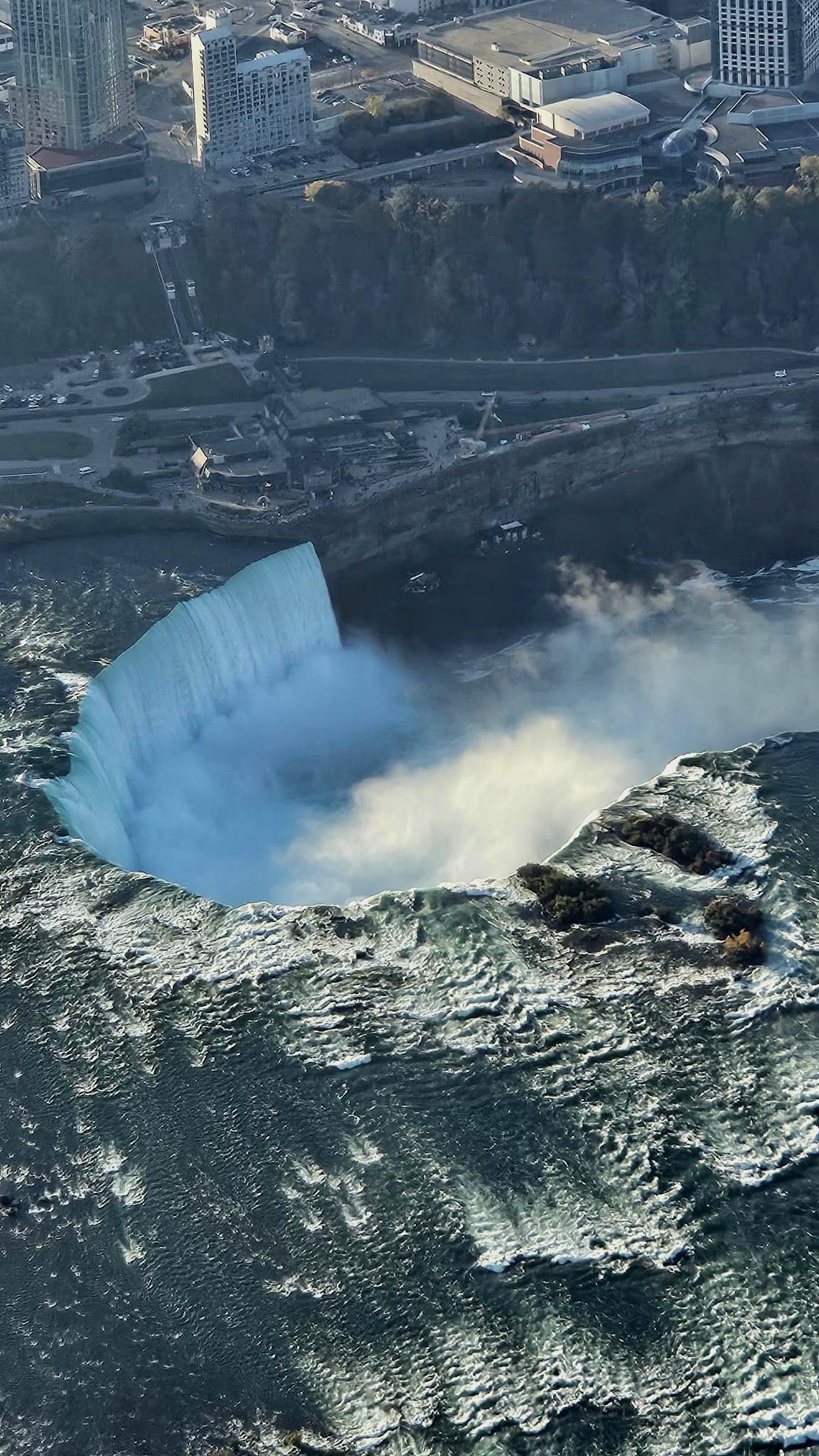
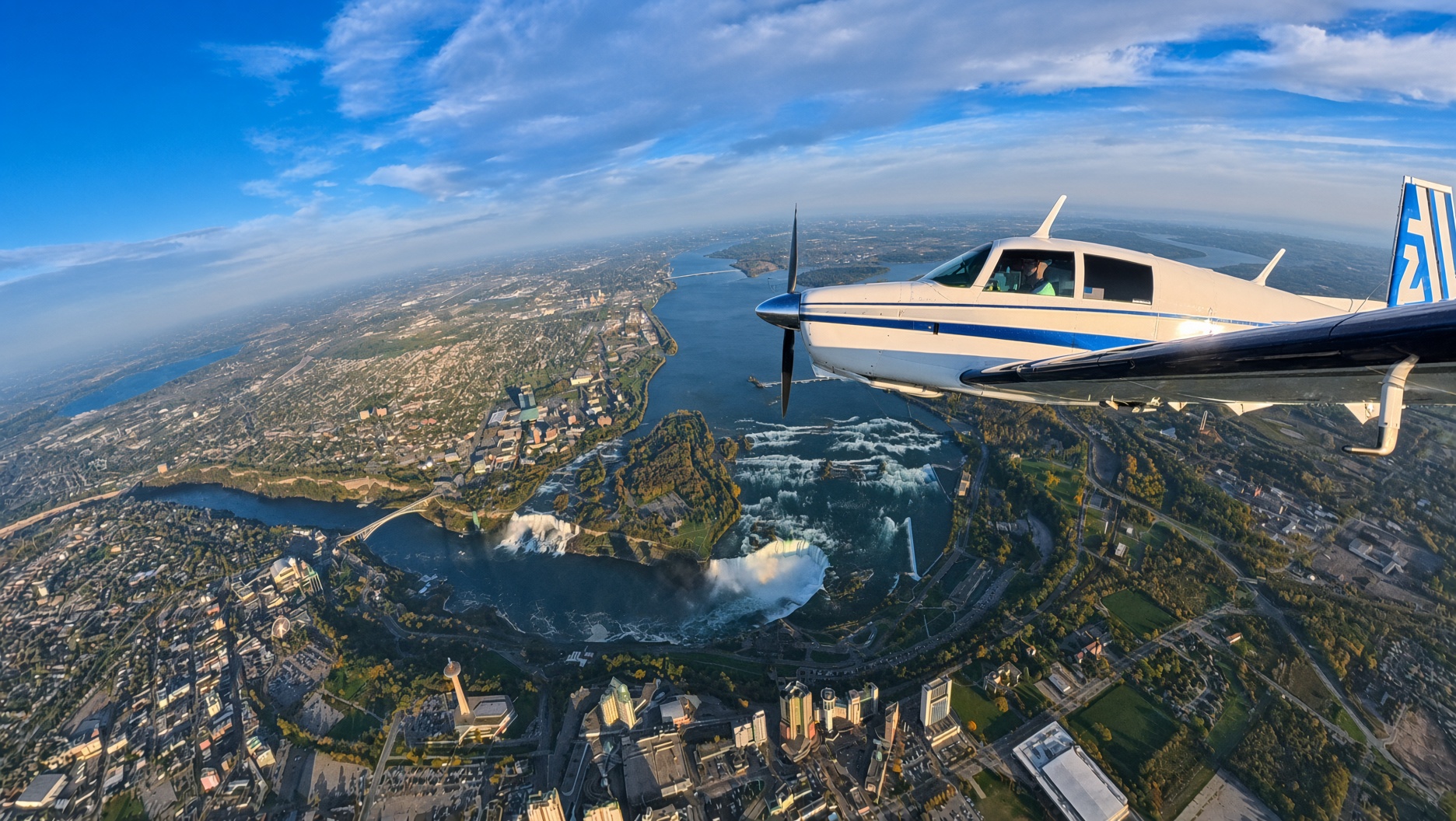
Flying over the falls was amazing—it is such an incredible perspective. It was not difficult to do. I had read the instructions and printed off everything prior to the beginning of the trip. I filed a VFR flight plan and was on flight following until they turned me loose to orbit the falls. In a nutshell, you fly at 3,500 feet or higher, clockwise in a racetrack pattern, making position calls on the specified frequency. After a handful of turns over the falls, we switched back to Approach and flew back to ROC, 173 miles in 1:13.
Stay tuned next month for Part II, including New York City and the Hudson River Corridor, the incredible leaves in the New England area, more states checked off the list, and the trip back home.