
We were so close. We had flown over 650 miles from our departure airport with one fuel stop and we were only five miles from our destination. All we had to do was turn onto final. Instead, we turned around and headed for an alternate.
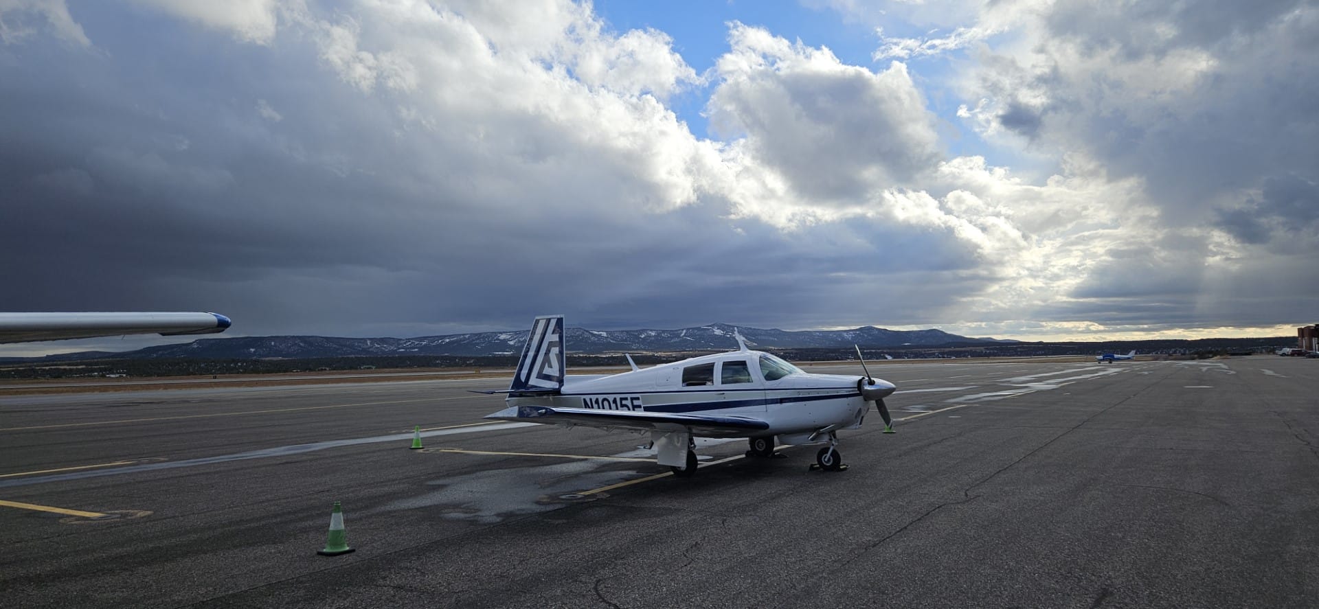
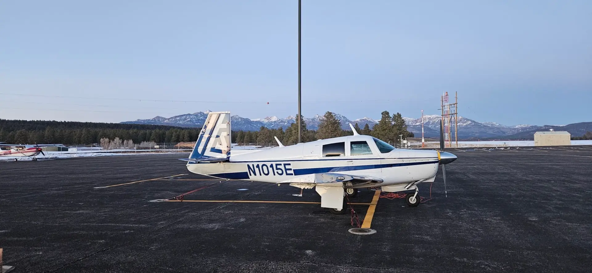
A short body Mooney, C/D/E model is great for just about everything. You can go on local “flightseeing” trips and make the $100 burger run, but the long cross country is where it really excels. One of the biggest driving factors in my plane choice was something economical (as much as a private plane can be economical) and fast enough to get us to Arizona/Utah/Idaho from Southern California in a reasonable time.
One of the biggest challenges on long cross-country flights, (50 miles isn’t long even if the FAA says it counts), is flying through different weather systems along with the possibility of the weather changing while enroute. Flying in the mountain southwest, during the summer the biggest concern is convective activity and thunderstorms. You can almost avoid those by always flying in the morning. During the winter it is icing, which can be an issue any time of the day.
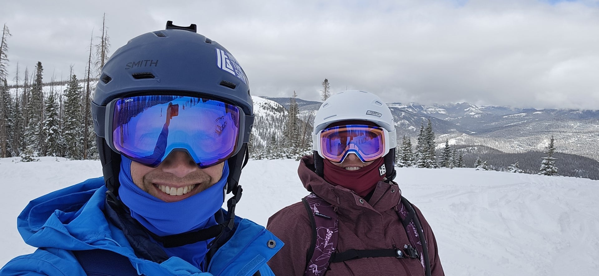
Winter is here, and along with it trips to our home in Pagosa Springs, CO and skiing at Wolf Creek. I started watching the extended forecast 10 days out, comparing the changes each day as the trip approached to see if there were any storms, and if so, which direction they were trending. Last year my perfect record of flying to Pagosa was broken when I had to drive because of forecast storms. The storms were everything that was forecast, I was glad I decided to drive, and we skied three days of powder, it was epic.
The typical trip is to arrive on Wednesday, ski Thursday through Saturday, and fly home Sunday. The forecast showed some possible snow on Wednesday, snow on Thursday, and sunny skies Friday through Sunday. I decided that it was worth flying Wednesday even if we had to stop short at Durango (KDRO) or Farmington (KFMN) and get a vehicle for the remainder of the trip. My concern is not only getting into KPSO, it is getting stuck there if a storm moves in, but with days of forecast sunshine I knew we wouldn’t get stuck there.
My wife asked the day before what time we needed to leave. She’s always flexible about departure times knowing that no plan is set in stone. The evening before to forecast was looking like some snow in the morning, tapering off late morning, and then a window of VFR from around noon until the evening.
I planned to leave in time to arrive between 1-2pm, allowing for a fuel stop at Williams (KCMR) on the way. The forecast winds would allow us to fly straight through, arriving right at my minimum 10 gallons on board, but knowing the possibility of changing visibility at Pagosa enroute I wanted to stop and have an extra buffer of fuel.
Wednesday morning, I got on my laptop and checked the weather briefing which still showed the open arrival window from 1pm until the evening so we proceeded with our planned departure. I had filed both a VFR and IFR flight plan for the KFUL to KCMR leg the night before with a forecast marine layer in the morning. The weather briefing in the morning showed that the marine layer would likely still be there at our departure time, so I reviewed the typical departure I get when leaving KFUL.
Arriving at the hangar the marine layer had completely burned off. After loading up the plane, pre-flight, taxi and run-up I called up ground.
Me: “Fullerton Ground, Mooney 1015echo, southeast runup with Lima, request taxi two-four.”
Ground: “Mooney 1015echo, I have an IFR plan on file for you, did you want that clearance?”
Me: “No, I thought we were going to have a marine layer but it’s clear.”
Ground: “Roger, I’ll cancel that plan, taxi two-four via Alpha.”
Me: “Two-four via Alpha, thanks, 15echo.”
The flight to Williams was smooth and uneventful, the best kind of flight. There were a few little bumps on the descent, but when you are descending from 9,500’ to a pattern altitude of 7,700’ it’s a short descent. It was a typical turn on the ground, topping off both tanks, a visit to the restroom, and we were back in the air just over 30 minutes later. When you take off from a field elevation of 6,680’ it’s a quick climb to cruise and we were soon leaned out and on the final leg of the trip.
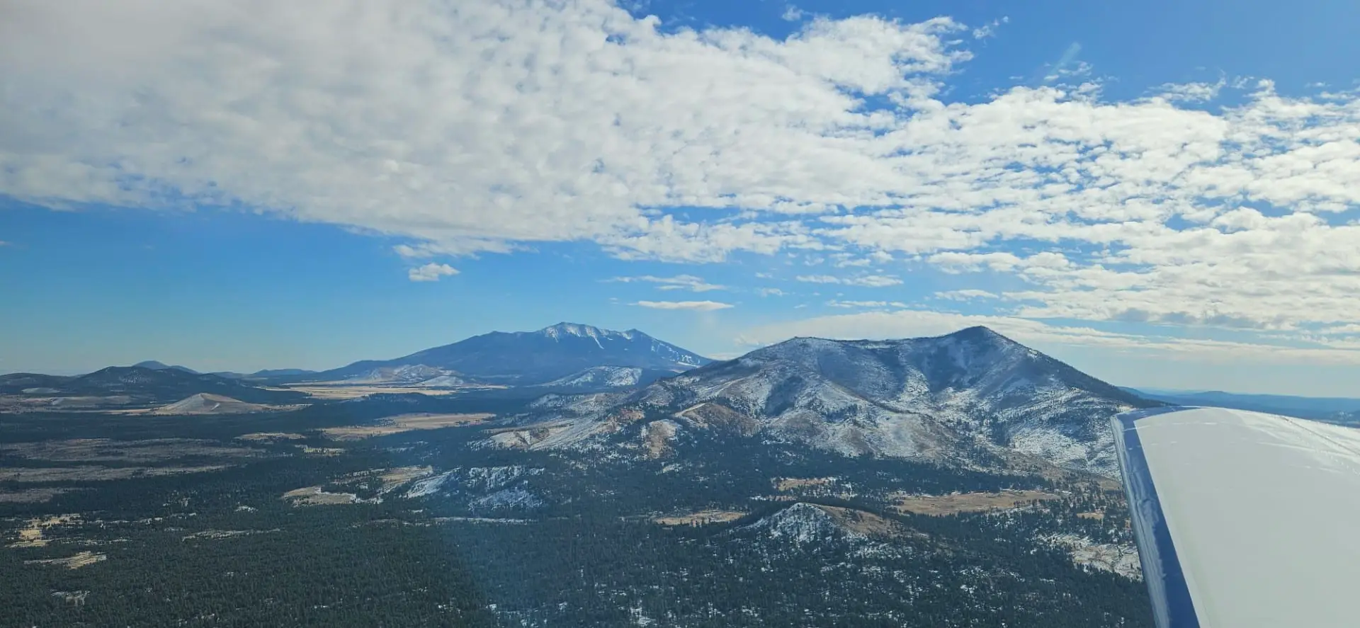
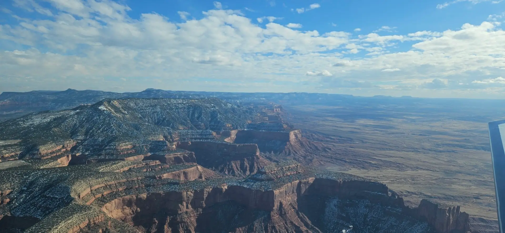
We flew past Sitgreaves Mountain with a light dusting of snow and Humphreys Peak, then across the Painted Desert, Chinle Valley and past Ship Rock, jutting up from the desert floor with its long spines stretching out to the south and west.
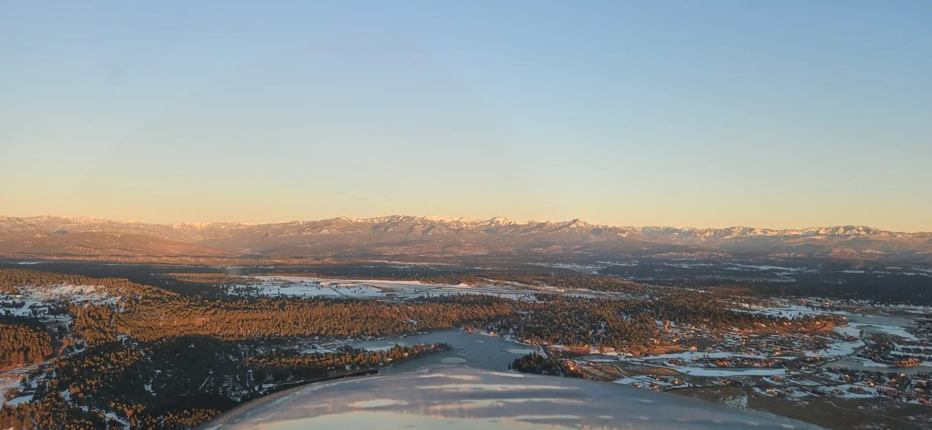
Passing Farmington off our right wing to the south I could see Durango ahead to the left and 70+ miles in the distance I could see the San Juan Mountains on the far side of Pagosa jutting up into the overcast sky. At this point in the flight with about 25 minutes left to go I was feeling pretty good about our chances to get into KPSO.
Surveying the skies ahead I told my wife, “It’s nice and clear out towards Durango, and you can see the mountains on the far, far side of Pagosa so I’m not worried about getting in.” Pagosa was off to our 10 o’clock position, and pointing to about one o’clock I said, “Down out here there are snow showers that are supposed to be coming this direction, which is why I wanted to get in around one-two o’clock. Because later it’s supposed to get worse, and early it was bad. When we took off (from Williams) it was low IFR conditions because it was snowing with less than a mile visibility. The forecast showed that there was this four/five hour window.”
“My plan was to get here, and get to the mouth of the canyon and if everything was clear, like there was nothing moving in from the sides or anything else we would go, and if it was sketchy looking, we could just make a turn and go back to Durango or go back to Farmington. We have lots of options, we have three hours of fuel, which is also why I wanted to stop in Williams. We had enough fuel we could get to Pagosa, but if we got there and had to turn around, we would get into my one-hour reserve and I don’t want to get into my one hour reserve.”
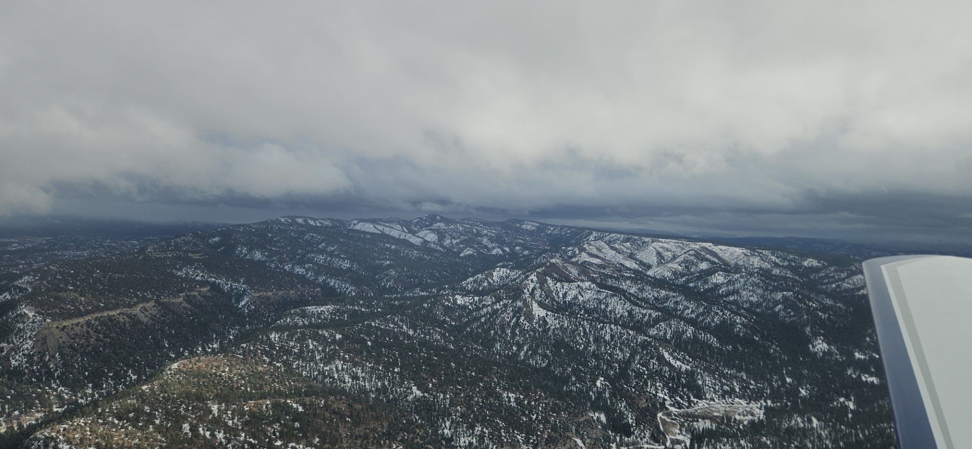
At this point we were 30 minutes from landing at KPSO, but things can change quickly in the mountains in the winter. We were about 35 miles from the mouth of the canyon which would leave us with a 30-mile flight up the canyon to the airport.
I put my second radio on the AWOS for KPSO and seven minutes later we were close enough to pick up the weather.
“Pagosa Springs Stevens Field, automated weather observation, two-zero-five-niner zulu, weather, wind calm, visibility five, unknown precipitation, ceiling one-thousand-five hundred broken, two-thousand overcast, temperature two Celsius, dew point zero, altimeter three-zero-two-zero.”
With a field elevation of 7,663’ we wouldn’t need to descend much from our cruising altitude of 9,500’ to stay below that broken layer. We pressed onward. Six minutes later we were turning up the canyon and I listened to the weather again.
“Pagosa Springs Stevens Field, automated weather observation, two-one-zero-five-zulu, weather, wind calm, visibility four, unknown precipitation, ceiling one-thousand-three hundred broken, two-thousand overcast, temperature two Celsius, dew point one, altimeter three-zero-two-zero.”
Completely focused ahead I kept the Unicom frequency on radio one with the AWOS playing in a continual loop on radio two.
“Pagosa Springs Stevens Field, automated weather observation, two-one-zero-six zulu, weather, wind calm, visibility four, unknown precipitation, one-thousand scattered, ceiling one-thousand-six hundred overcast, two-thousand overcast, temperature two Celsius, dew point one, altimeter three-zero-two-zero.”
This was my ninth trip up the canyon to KPSO and I am very familiar with all the landmarks. I kept to the right side of the canyon knowing that if I needed to turn around a left turn would keep me away from all the rocks at my current altitude. Still, the AWOS played constantly in my ear.
“Pagosa Springs Stevens Field, automated weather observation, two-one-zero-seven zulu, weather, wind calm, visibility three, unknown precipitation, seven-hundred scattered, ceiling one-thousand-three-hundred broken, one-thousand-niner-hundred overcast, temperature two Celsius, dew point one, altimeter three-zero-two-zero.”
If you’ve never flown in or around snow, it can lure you in and take you by surprise. I was at traffic pattern altitude, cruising along at 8,700’ and knew that with the scattered layer I might need to go around a little cloud here or there. However, with the snow up ahead there was no definition to the clouds like there would be if you were flying around a scattered layer on a relatively clear day.
Two minutes and six miles later:
“Pagosa Springs Stevens Field, automated weather observation, two-one-zero-niner zulu, weather, wind calm, visibility three, light snow, seven-hundred scattered, ceiling one-thousand-three-hundred broken, one-thousand-niner hundred overcast, temperature two Celsius, dew point one, altimeter three-zero-two-zero.”
If it stayed at three miles, I would be comfortable landing, but if the reported visibility dropped below three miles I would turn around. I was losing hope that we would make it in. I made a radio call, “Pagosa Springs traffic, Mooney one-zero-one-five-echo, eight miles to the southwest, inbound, be straight in runway one, Pagosa Springs.”
Two more cycles of the weather the decision was made.
“Pagosa Springs Stevens Field, automated weather observation, two-one-one-one zulu, weather, wind calm, visibility two, light snow….”
With that report I rolled into a gentle left bank and back out down the canyon. I had put the visual approach into the GPS NAV and we were almost on the centerline, only five miles from the airport. I was pleased that I had given myself a hard line and when the visibility dropped below it without debating it internally, I turned around.
I made a last call on the UNICOM, “Pagosa Springs traffic, Mooney one-zero-one-five-echo, we are going to head back out, wait for things to clear, Pagosa Springs.”
I knew that they listen to the radio in the FBO, and I didn’t want them wondering if we had gone into the ground somewhere. Back outside the mouth of the canyon I powered back and began circling to stay in radio range, listening to the one-minute weather. The radar showed that the snow should blow through quickly and knowing that the ADS-B weather is delayed I thought we might get in after about 15 minutes.
Fourteen minutes later as the visibility went back and forth between 1 ¼ mile and ¾ mile I gave up. I looked on my tablet and saw Skywest flight on final going into Durango. That would be the flight that my friend was on, scheduled to land at 14:45. I sent him a text that we were going to be landing at Durango to see if we could hitch a ride with him to Pagosa, then pointed the plane to Durango and dialed in the AWOS to get the weather.
“Durango La Plata County Airport, Durango Colorado, automated weather observation two-one-three-two zulu, wind one-zero-zero at zero-niner, peak gusts two-zero, visibility one-zero, sky condition broken four-thousand three-hundred, temperature zero-niner Celsius, dewpoint zero-zero Celsius, altimeter three-zero-one-two, remarks, density altitude seven-thousand three-hundred.”
It would be a sporty landing with a crosswind component of about 8 and crosswind gust factor of about 19. We crossed over mid-field before turning onto a left downwind for runway 3 and entering the traffic pattern. Coming down final I transitioned from a crab to a slip with the rudder mashed all the way to the floor and the right wing very low, just trying to hold onto the centerline.
The right main, followed by the left main touched the ground. As the nose wheel settled onto the runway, I was proud of myself, it was as smooth as any that I have greased on with a wind coming straight down the runway.
“Oh, wow…” I said, “not bad for a…”
“Side slipper” my wife interjected.
“Holy cow, I had the rudder stomped all the way to the ground,” I said finishing my sentence.
“I had to close my eyes,” she said.
“Oh, you should have kept them open, that was beautiful” I replied.
Her response was, “I was like, that’s going to happen I don’t want to know how.”
We taxied to the FBO and told them we would be there for a few days, coming back either Friday or Saturday to pick up the plane. My friend re-routed his Uber driver to pick us up and we had a nice drive to Pagosa.
Thursday we skied some good powder with it snowing off and on most of the day.
Friday was a bluebird day without a cloud in the sky. We stopped skiing in the early afternoon to have time to drive to Durango so that I could get the plane back to KPSO before sundown. As we were driving along, looking up at the clear blue skies, I commented to my wife, “They always say the accident investigation always happens under clear skies.”
“What was that?” she asked, only half listening to what I had said.
“Every time someone pushes it into the weather and crashes it seems that the accident investigation always happens under clear blue skies,” I said. She dropped me off at the FBO and began the drive back while I went through pre-flight, waited what seemed like forever for the engine to warm-up, and made the 15-minute flight from KDRO to KPSO. As I flew along with unlimited visibility, I reflected again upon my decision two days earlier to draw a hard line and not cross over it, grateful I hadn’t pushed on and likely become a statistic.
By the time I had the plane tied down, the engine heater plugged in, and walked over to the FBO my wife was pulling into the parking lot.
