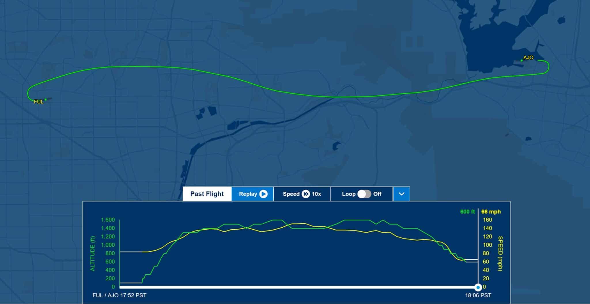
Fullerton (KFUL) to Corona (KAJO)
I like flying after work on Wednesday’s when the weather and my schedule permits. It’s convenient, the airport is just a few miles from where I end my workday, and it is a great way to unwind after a day at work. Even if it is more than a casual flight, it is still flying, and that is therapeutic.
It was the day after Christmas when I got a text from a friend. “Are you flying this Wednesday? If so, may I join you?”
She’s a pilot with a Mooney which is currently down for some maintenance.
“I was thinking of a short flight after work. I would be there just after 5pm. Happy to have you come along,” I replied.
Wednesday the weather wasn’t fantastic, but good enough for an evening flight.
To carry passengers at night, which is the time between one hour after sunset and one hour before sunrise you must have three night takeoffs and three full stop landings in the previous 90 days. It would be good to get in some night takeoffs and landings to reset that 90 day clock.
We met up at my hangar and after completing my pre-flight inspection went over the plan. We would fly to Corona (KAJO) for the first landing, then to Chino (KCNO) for a second landing, before returning to Fullerton (KFUL).
Fullerton was reporting 3 miles visibility with a scattered layer at 1,500′ and overcast at 2,000′. Corona and Chino were both clear skies with 4 miles visibility.
It was very hazy, or maybe it was misty that was contributing to the 3 miles visibility, but either way I switched off my landing light after leaving KFUL’s airspace which increased the visibility. With the light on reflecting off whatever was in the air it was difficult to see the ground references, but as soon as it was flipped off everything was clear.
Out past the layer of clouds I flipped the landing light back on for the added visibility to other planes. I climbed up to 1,600′ passing through the Santa Ana Canyon which also put us right at traffic pattern altitude.
Airports typically update the ATIS (Automatic Terminal Information Service) about 7-10 minutes before the hour unless there is a significant change in the weather. Looking at the time clock I figured KCNO wouldn’t chagne the ATIS between our landing at KAJO and arrival at KCNO.
Before entering I listened in to the ATIS at KCNO so there would be one less thing to do on the next leg of the flight. There was one other plane in the traffic pattern at Corona and I spotted his lights as he turned his base leg while we were on downwind.
The landing was good and we taxied off and back to runway 25.
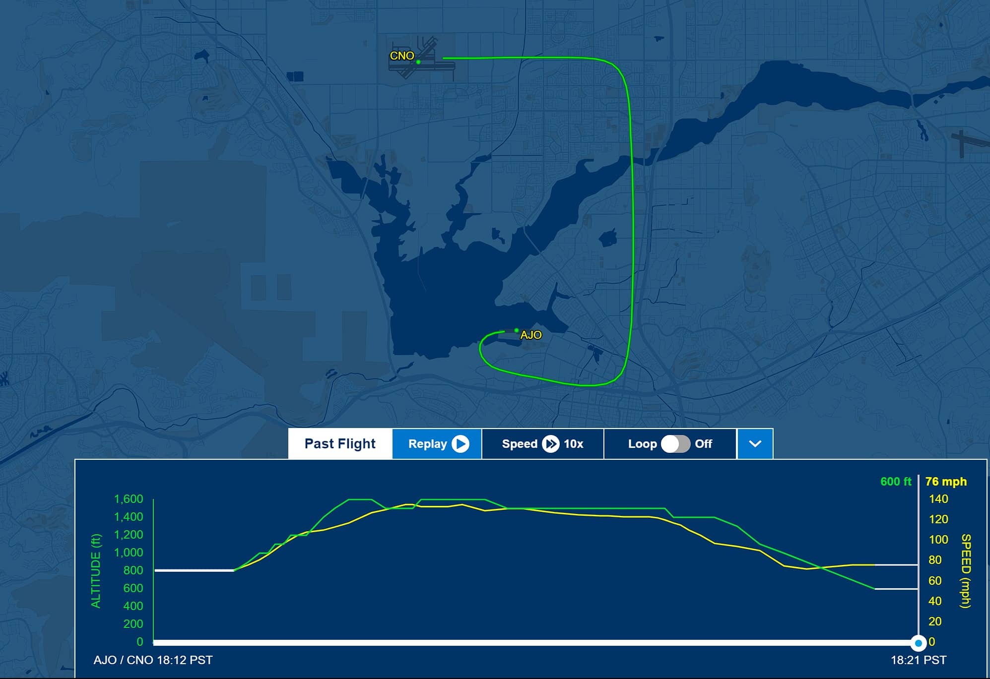
Corona (KAJO) to Chino (KCNO)
I went through my takeoff checklist and with nobody else in the pattern took the runway and slid the throttle in all the way.
As the nose of the plane came up and we began a climb I lost all ground reference. Off the departure end of 25 at KAJO is nothing but woods and the area of Prado Dam with Chino Hills State Park lying beyond. With the cowling and wings blocking the runway lights just after lifting off it was a black hole departure.
“Wow, black hole,” I commented as I quit looking out the windscreen and focused on the instruments to stay in a wings level climb. It was only a few moments before we climbed enough to start my crosswind turn and begin to see ground reference lights again, but a few moments is all it would take to get in trouble.
I flew the downwind leg and pulled up the KCNO ATIS frequency on the second radio long enough to verify it hadn’t changed before calling up Tower.
A short 9 minutes after taking off we landed at KCNO and requested a taxi back. There were a couple of helicopters doing pattern work and as we taxied to 26R I watched some landing lights that looked like they were falling straight down. One of the helicopters was practicing auto-rotations.
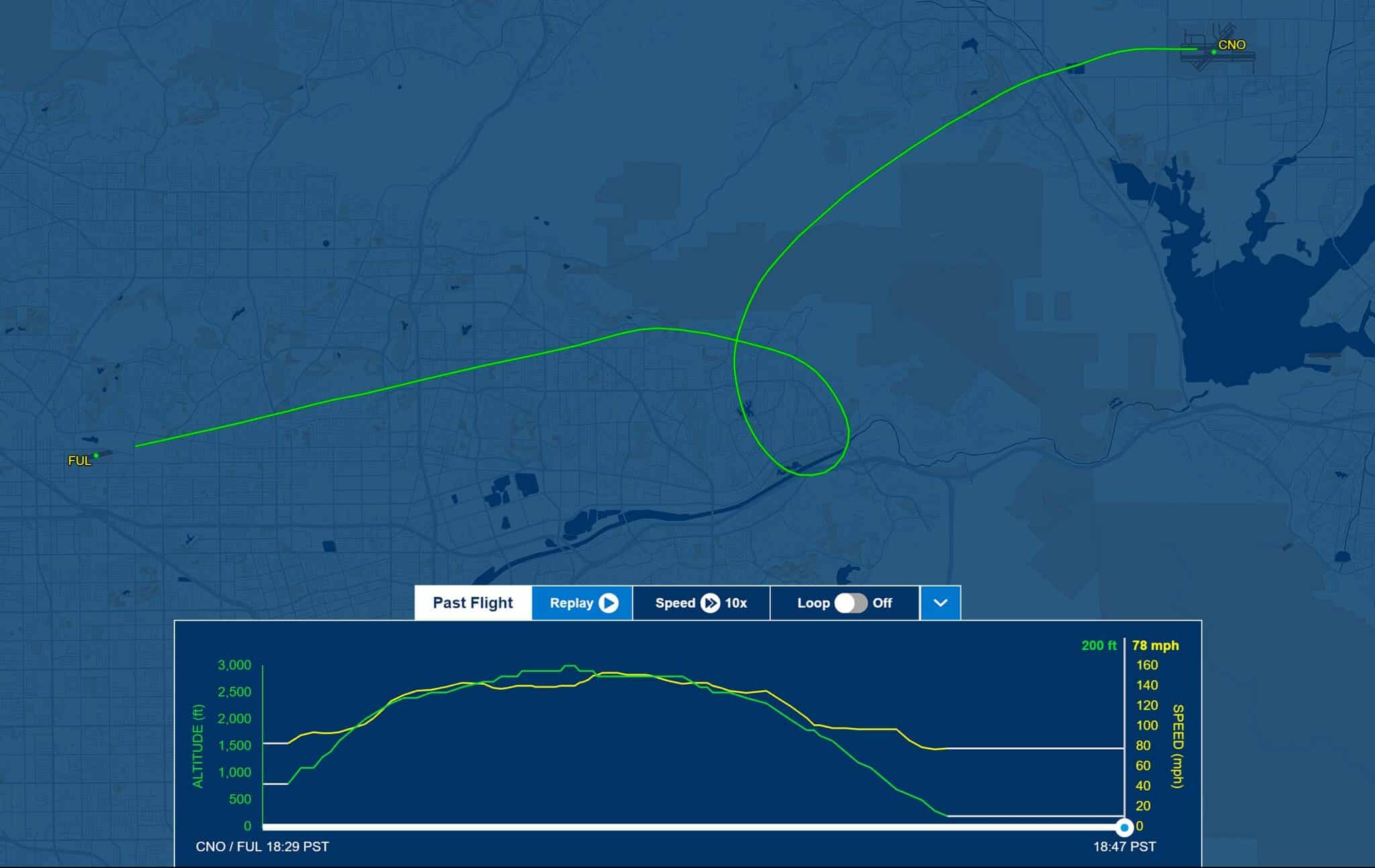
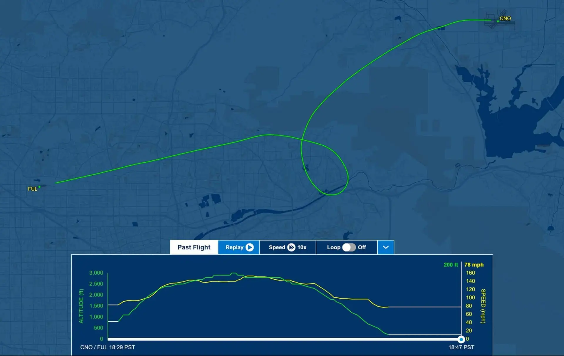
Chino (KCNO) to Fullerton (KFUL) - Pop-up IFR Clearance
The hills of Chino Hills State Park between KCNO and KFUL top out at 1,781′ and there are also power lines that run along some of the ridges. That eliminates the possibility of flying at even 2,000′ which is what KFUL had been reporting as their overcast.
Still, I thought we could climb up to 2,500′ to cross the hills and then duck under the layer, a reverse of what we had done on our departure from KFUL. I could have picked up a TEC (Terminal Enroute Control) Route but thought with only 30 minutes passing since we left KFUL we would be able to get back VFR. I thought wrong.
The skies over the Inland Empire were clear with an almost full moon having climbed above the clouds far to the east. It was beautiful.
The tower had us fly runway heading until we got past an inbound plane and then turned us loose to fly “own navigation” along with a frequency change.
KFUL was still reporting the same ATIS information as when we had left, but as we crossed over Chino Hills I could see it wasn’t going to work.
That layer that had ended before the hills on our way out had pushed all the way up against them. Off to my left I could see the lights of cars on the 91 Freeway going through the Santa Ana Canyon. If a pilot was inclined to scud run they “could” go over and duck under that layer, but that would be risky and there are lots of accidents that have resulted from scud running.
We were at 3,000′ and near LEYMI which is on of the fixes on the RNAV 24 approach into KFUL. I switched from KFUL Tower frequency over to SoCal Approach to make my request.
Me: “SoCal Approach, Mooney 1015E, we’re at 3,000′ over LEYMI requesting a pop-up IFR to Fullerton.”
There were a couple other transmissions between the controller and a plane he was vectoring before he came back.
Approach: “Who was requesting the pop-up?”
Me: “Mooney 1015E”
Approach: “Mooney 1015E, squawk xxxx, and which approach did you want?
Me: “Squawk xxxx, and the RNAV 24, 15E.”
Approach: “Mooney 1015E, radar contact 1 mile south of LEYMI, standby for your clearance.”
There’s a significant difference in the routing he would need to give for the VOR approach to KFUL and the RNAV. We were setup perfectly for the RNAV and it would also keep us away from all of his downwind traffic going into John Wayne (KSNA).
I began a gradual left turn to stay clear of KSNA’s airspace and after a short moment he called us back up.
Approach: “Mooney 15E, I have your clearance, advise ready to copy.”
Me: “Ready, 15E.”
Approach: “Mooney 1015E, you are cleared to the Fullerton airport via left turn heading 310, maintain 3,000.”
Me: “Cleared to Fullerton via left turn heading 310, maintain 3,000, 15E.”
Shortly after that he gave us one more turn and cleared us for the approach, handing us off the the Tower. Tower cleared us to land and advised a helicopter that was inbound from the south that he would be number two behind us and to “advise when you have traffic in sight.”
I commented to my friend he wasn’t going to see us until we came out of the bottom of the clouds. We crossed LEYMI at 3,000′ and began our descent entering the clouds at about 2,400′ and breaking out at about 1,800′. Once we broke out I flipped my strobes back on and a few moments later the helicopter called out “traffic in sight.”
We landed and while taxiing back to my hangar I looked up and could see the moon shining down through clear skies. The cloud layer that was above Fullerton when we left had moved east up against the hills leaving behind clear skies above the airport. They hadn’t updated the ATIS, and from our vantage point as we crossed Chino Hills we couldn’t see the hole in the clouds ahead of us. The lights glowing up through the clouds from below and the moon shining off them from above made it look like a solid layer over the whole LA basin.
Not knowing the skies above the airport were clear we had picked up an IFR clearance which worked out great. I was able to l fly a stabalized approach as opposed to circling down over the airport, and because we were in the clouds prior to and after the FAF (Final Approach Fix) I was able to log it as an approach.