Kathy stayed behind in St George on Easter to spend the week with her Dad and Step-mom and to travel with them to Vancouver, WA later in the week for her Aunt’s Celebration of Life. Easter Sunday found myself flying back to SoCal solo on and then playing the bachelor role (going to work and eating leftovers) for the week. I also needed to find my own way to Washington in time for the Saturday event.
Travel Options
I had 2 ½ options. I could fly commercial there Friday evening after work and back on Sunday. I could fly myself there late Friday afternoon and back on Sunday. Or I could stay home, but I knew my wife wanted me there, which meant it wasn’t really a complete option and thus only half an option. It still was ½ an option because she knows that nothing is important enough to attempt a flight that shouldn’t be made.
The commercial option was about 2 ½ hours non-stop each way, packed inside a metal tube with a few hundred of my best friends I’ve never met. The Mooney would be a total of about 5 hours each way plus the time for a fuel stop enroute. Adding in the need to arrive at the airport 2 hours before the flight and commercial isn’t a huge time saver. When you add in the other negatives of TSA and going on the airline’s schedule, the commercial option becomes even more undesirable.
I won’t get into the price difference between flying commercial and flying my Mooney. The argument can rarely be made that flying myself is the fiscally responsible choice, but it is a lot more fun. I could also check another state off the list by landing in WA. The only deal breaker the commercial option had going for it, was that it’s that time of year when the temperatures aloft can still mean there’s ice in the clouds, and there are often clouds in the Pacific Northwest, which makes it a no-go in my plane.
Plan A
I assured my wife that I would follow the weather trends during the week and if needed by a ticket and ride the aluminum tube. On Monday it wasn’t looking great for making the trip in the Mooney. As the week progressed and I watched the trends on Windy for clouds, visibility, and cloud bases I became more hopeful that I wouldn’t be resigned to travelling with the huddled masses.
Unlike our April trip to Colorado that I wrote about last month which was very much in question the day before, by Thursday I was about 90% confident that I could make the flight. The only variable was the route I would take to get to Vancouver. I would need to go IFR to get out of the LA Basin Friday afternoon. After looking at fuel stop options I filed Thursday afternoon from Fullerton (KFUL) to Colusa County (O08).
I’ve made fuel stops in the vicinity of Sacramento before going to Redding, CA and Sun River, OR but had never been to O08. I like going into new airports. It keeps things interesting, and O08 had a decent price on fuel. Plus as an un-towered airport, it should be a quick fuel turn. I’ve found that going into an un-towered airport I can usually be fueled and back in the air in under 30 minutes.
The next decision was how to get from Colusa County to Pearson Field (KVUO) in Vancouver. The cloud forecast suggested that the route of O08 TALUM V23 OSWEG KVUO was going to be my best option. I would climb out through a few layers and be on top before the temps were below freezing, crossing the Cascades south of Mt Shasta and heading up the Willamette Valley. That was Plan A, but by Thursday evening I had to scrap it for Plan B. Thursday morning the tops forecast near Medford that were “supposed to be” around 8,000’ Friday afternoon when I would be flying had increased to the point I would be in the clouds and in icing conditions. That wasn’t going to work.
Shifting to Plan B
On Thursday evening I moved to Plan B. From O08 I would go RBL V25 KAGYE V25 LMT V452 EUG V23 BTG KVUO. This would keep me east of the Cascades longer, crossing near Crater Lake, and put me above the tops without adding much time to the trip. I made the amendment to my flight plan and went to bed. Friday morning I logged in to see the forecast from the evening before had changed again. It now showed mid-level clouds were going to push east past the Cascades, once again putting me in icing conditions, but I hadn’t given up hope yet.
That Won't Work - How about Plan C
The forecast discussion on https://aviationweather.gov/gfa/#afd said conditions east of the Cascades should be VFR/MVFR with some reduced visibility for rain showers. The cloud forecast along that route showed few to overcast with the bases varying from 3-5,000’. Putting the whole picture together I switched to Plan C. I would make the flight from O08 to KVUO via LMT V25 DSD and stay VFR. Going all the way north to the Deschutes VOR before turning northwest should also bring me to clear skies. I gave a brief look at flying IFR from O08 to the coast where the MEA’s are very low. It was doable, I would be well below the freezing level, but it would be a long time in the soup which held zero desire for me.
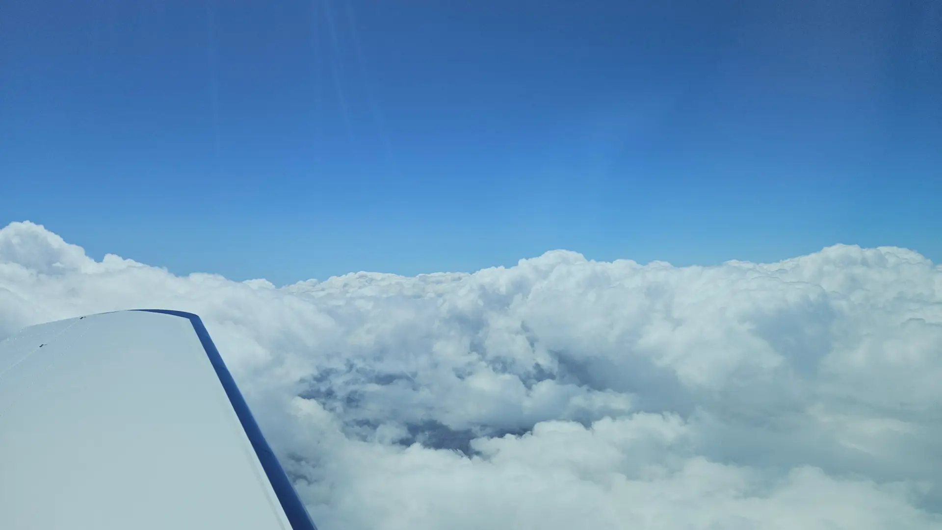
I worked half a day on Friday, headed to the airport, and was wheels up at 13:17. The tower handed me off to SoCal and was climbing up through layers with beautiful views of the LA Basin and the green hills through breaks in the clouds. Eventually I was in the solid stuff for about 10 minutes before breaking out on top into a glorious blue sky.
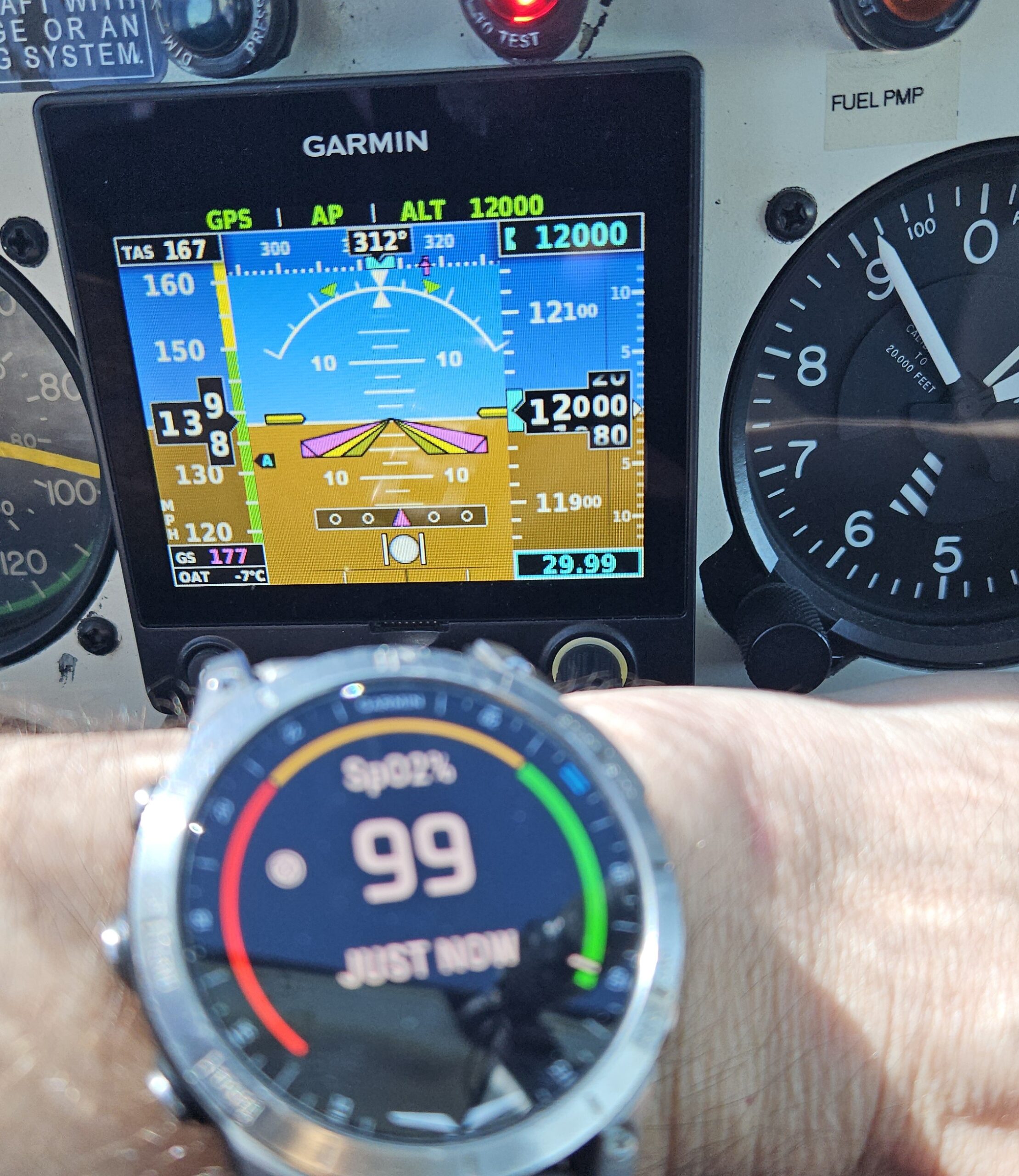
I was level at my cruising altitude of 10,000’ for a bit, but could see that would put me just into the tops of the clouds up ahead so asked for and was given 12,000’. With the O2 flowing from my Inogen One G5 my sats stayed in the upper 90’s and the ride was smooth.
After a short vector off the routing to move me out of the approach corridor for San Francisco, NorCal gave me direct destination cutting a few miles off the trip. Colusa doesn’t have any weather, but I had been looking at the weather on my tablet showing ceiling well above VFR at surrounding airports so when NorCal asked if I was planning on a visual approach I responded “Affirmative.”
After a descent through the cloud layer and about 30 miles from the airport I canceled IFR but stayed on for traffic advisories. The landing and refueling at O08 went well and I took a few minutes to check the weather along my route to see if anything had changed since I got my briefing before leaving KFUL. There were no updates to TAF’s, and the conditions were still VFR at all the airports along the route. The only variable was if the conditions began to deteriorate. I called my wife to let her know things looked good and I was going to be taking off soon.
Klamath Falls could be the final stop for the day.
“If I make it past Klamath Falls, I’ll be good the rest of the way. If not, I’ll land to wait it out and stay the night if needed,” I told her.
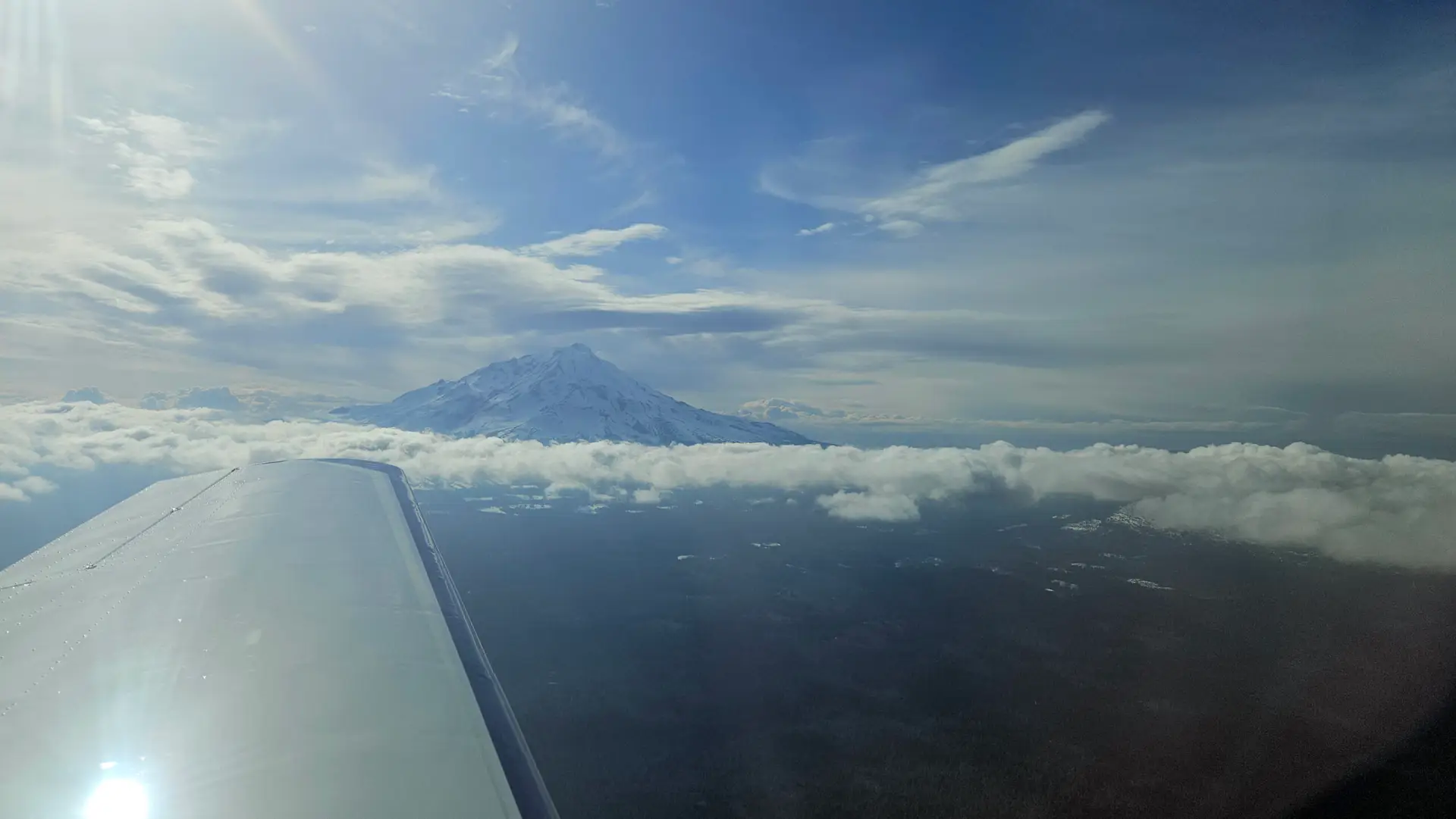
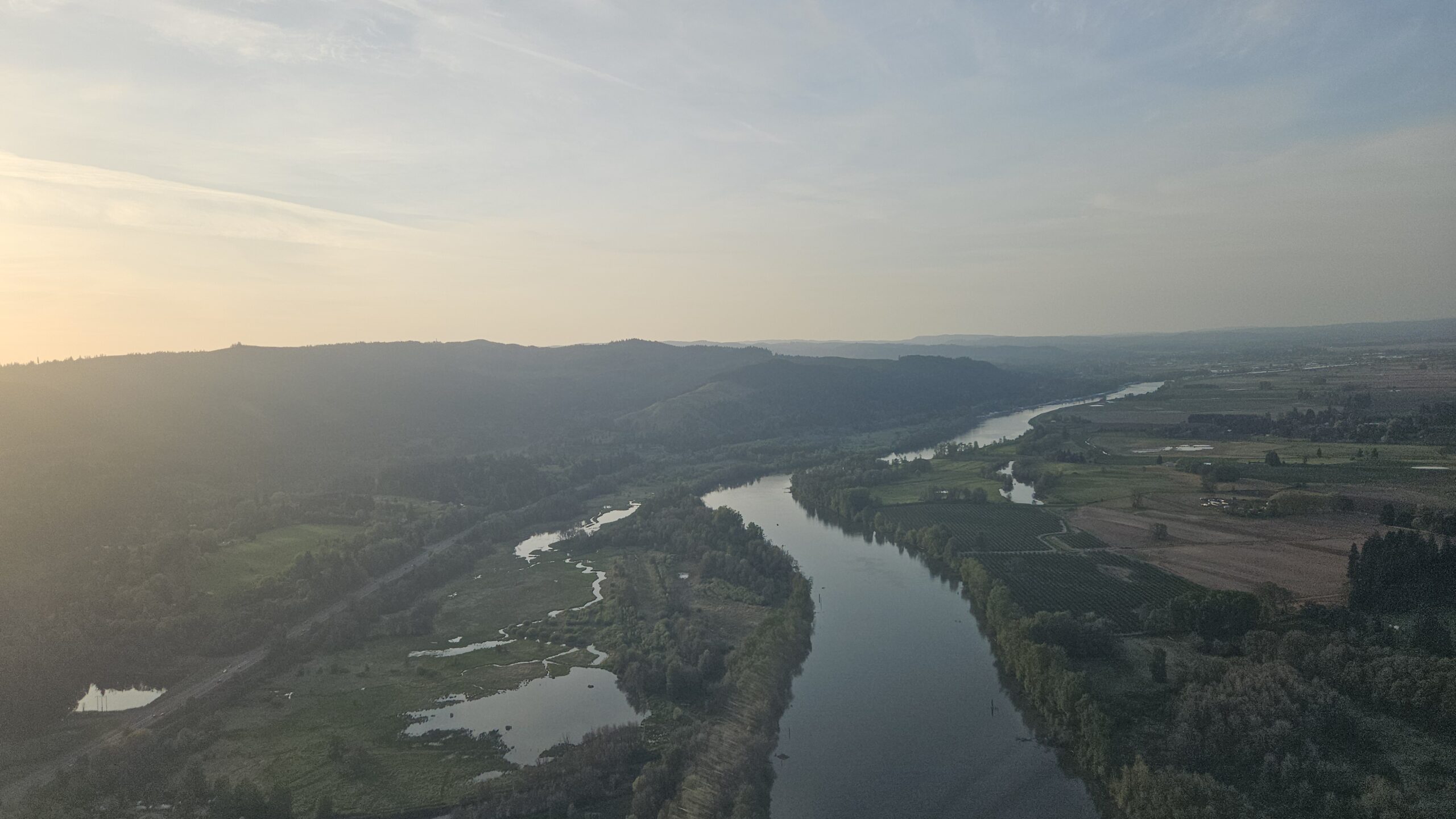
Twenty-five minutes after landing I was back in the air, leveling off below a scattered to broken layer, making my way north past Redding toward Klamath Falls. Passing up the valley east of Lake Shasta it was apparent that I was going to run out of clearance below the clouds with the rising terrain ahead. The scattered layer was leaning more to the “few” side of the spectrum and there was plenty of room for me to climb above the clouds. Roughly 15 miles off my left wing was Mt. Shasta with her eastern slopes shadowed by the late afternoon sun, and beyond it, I could see the clouds that had pushed me to take the eastern route.
I was approaching Klamath Falls and would soon know if I can continue to Vancouver. The spares clouds below me gradually faded away and the clear skies above became overcast. A very light rain was falling and I could make out no discernable base to gauge my altitude beneath them. Klamath Falls was reporting overcast at 5,000’ putting the bases somewhere around 9,400’.
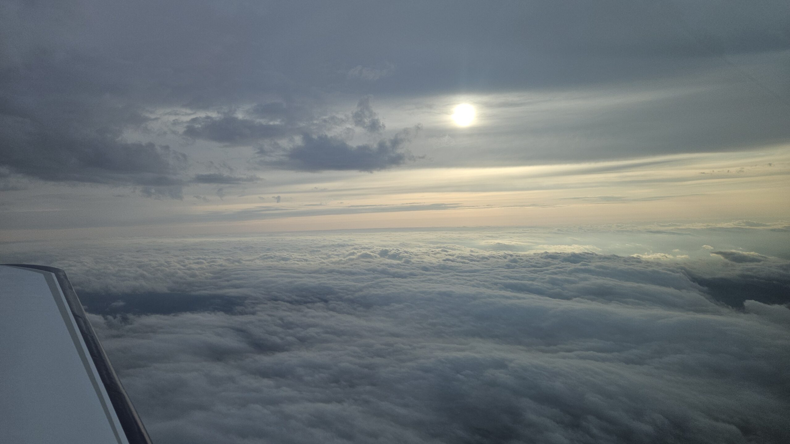
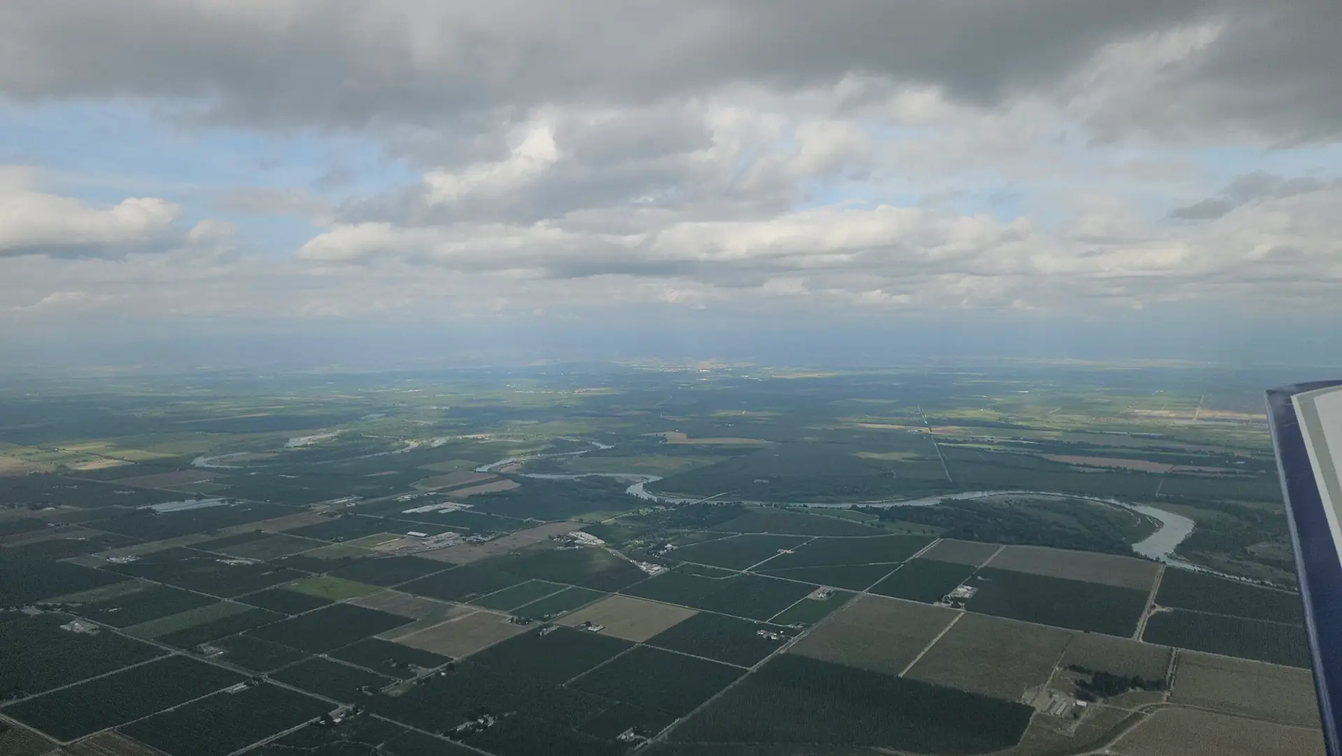
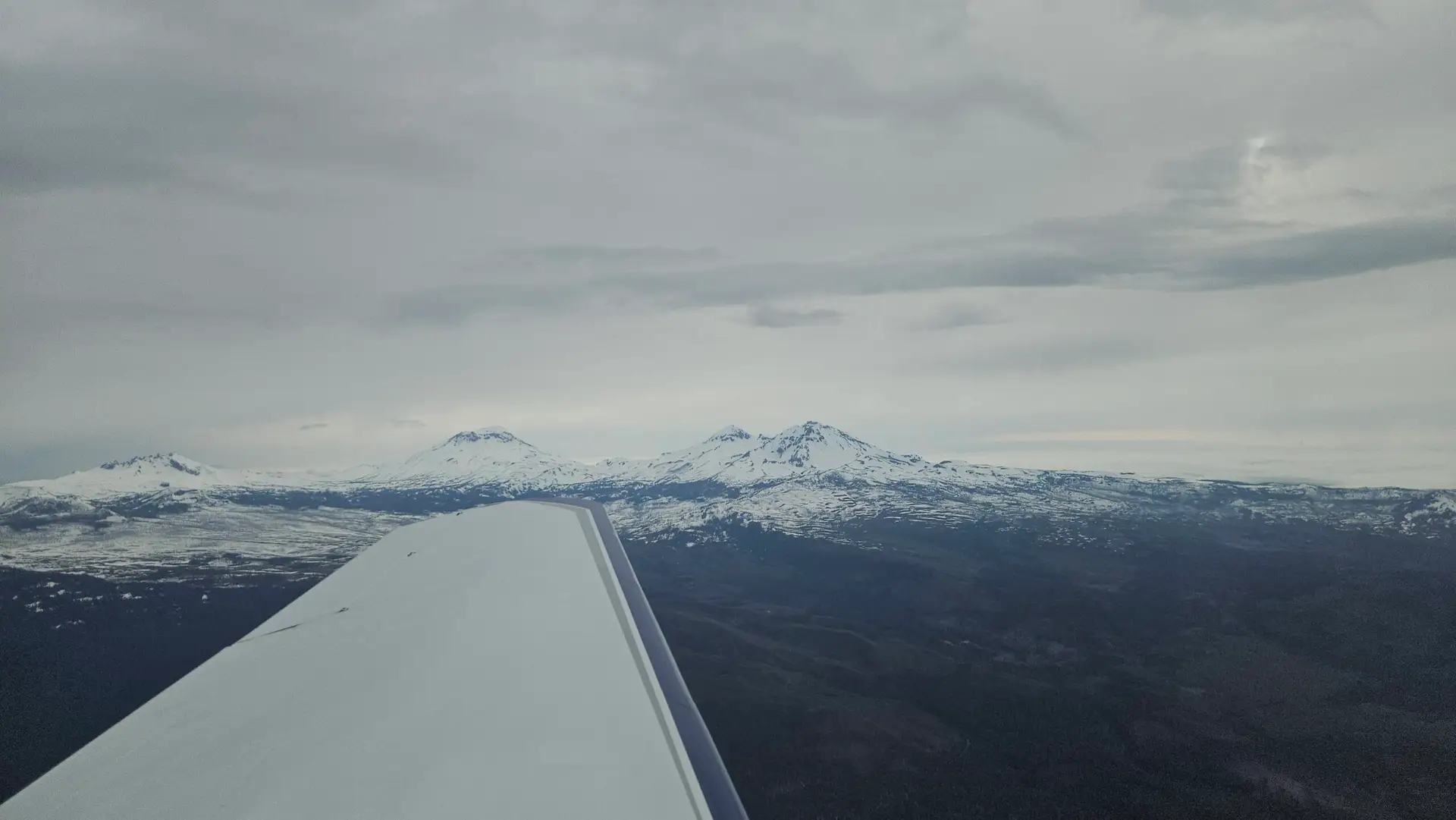
Leveling off at 7,000’ I flew north through the light rain, with visibility somewhere around 4-6 miles. About 45 minutes later the rain stopped and I was flying below a gradually thinning overcast layer. Passing the Three Sisters the sun was trying to peek through the clouds. Low clouds were piled up against the west side of Mt Jefferson and the Cascades so I climbed to get above them, knowing the skies over Portland were clear and I would be able to descend somewhere up ahead. Roughly 50 miles to the north the setting sun lit up Mt Hood with a collar of clouds hiding her base.
Arriving at Pearson Field
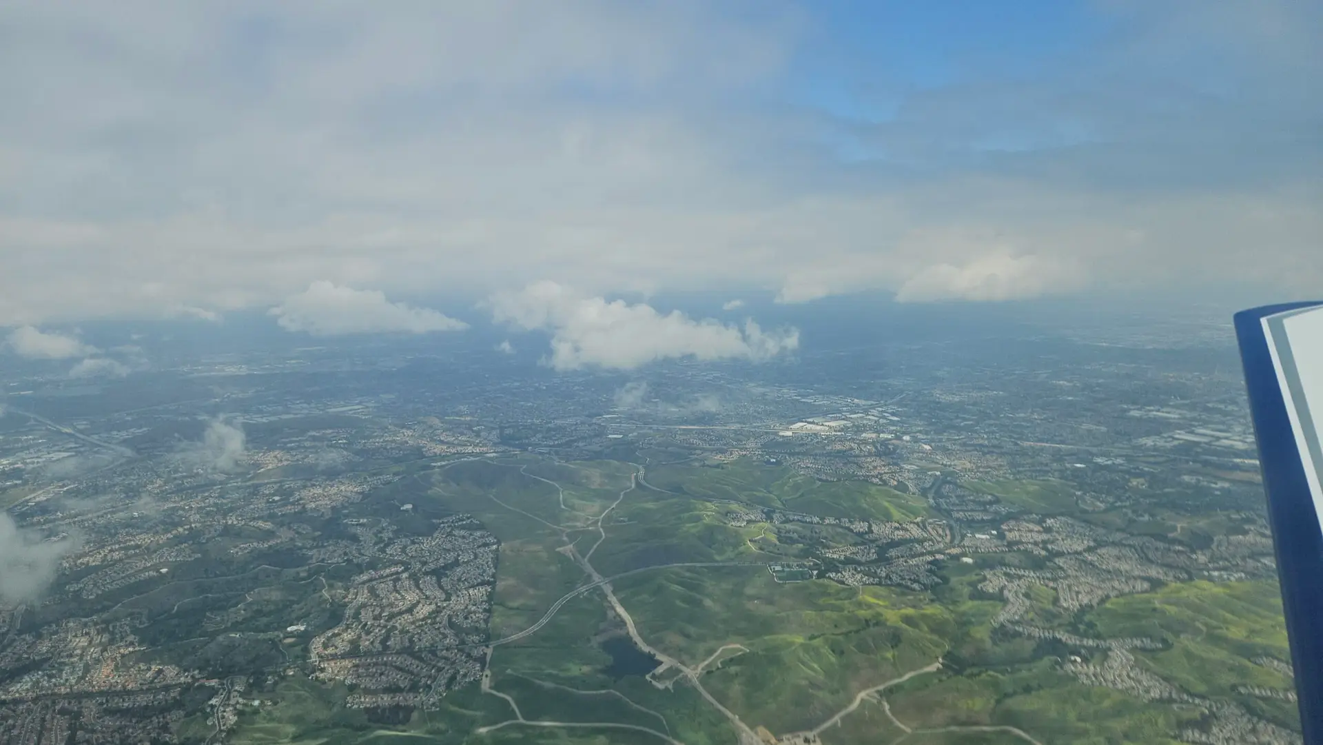
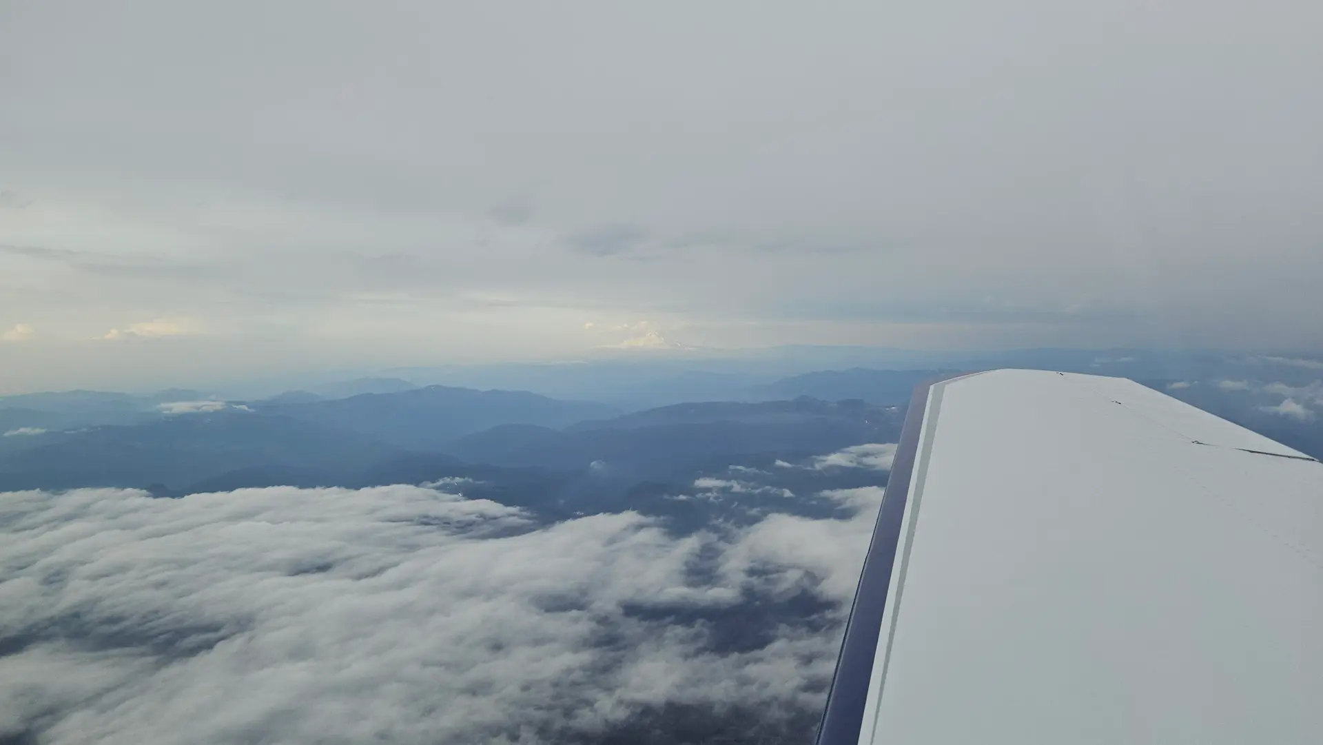
The sun was shining through the overcast and off to the west where the skies were clear, it lit up the clouds below me. I started my descent with the sun dipping toward the western horizon giving a golden hue to the skies as I flew over Beaverton and around the west side of PDX’s airspace. Before crossing over the Columbia River I called up Pearson Advisory. They advised me PDX was operating to the west and advised about wake turbulence.
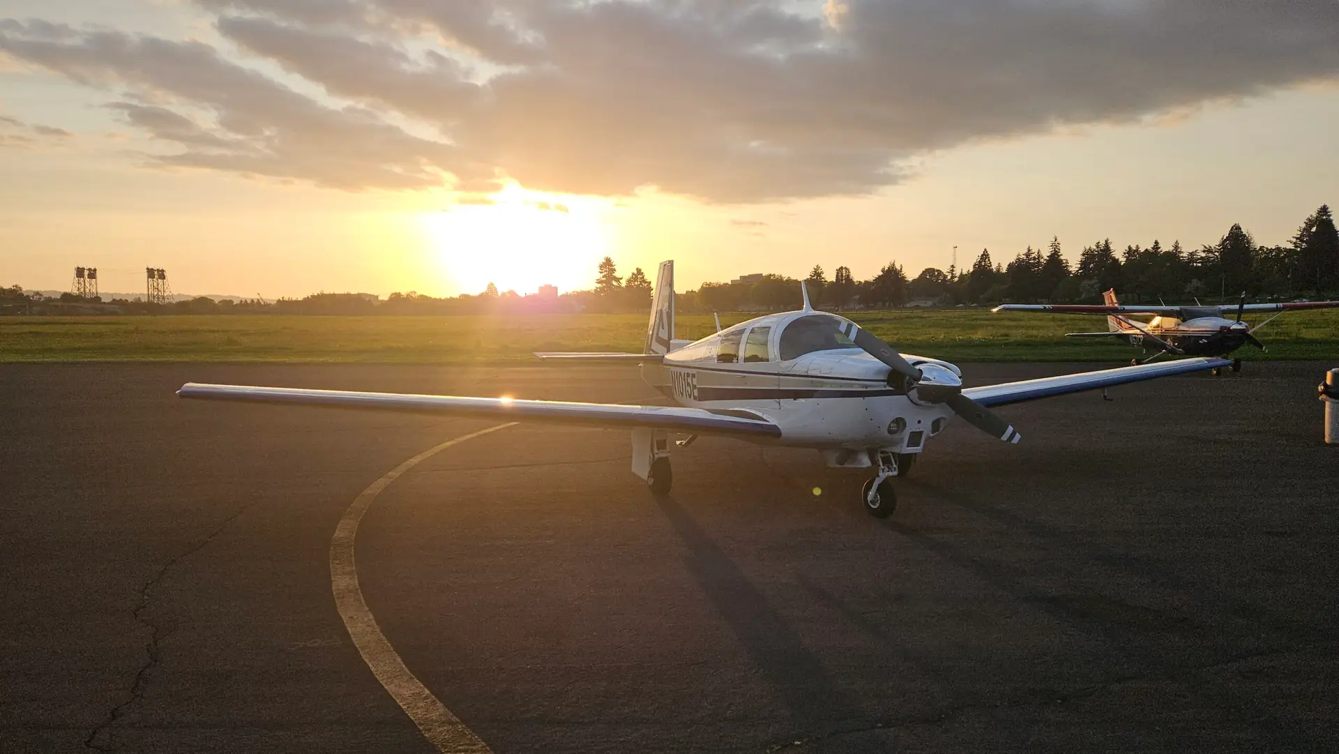
The two airports are only about 3 miles apart and the departures from PDX go right over VUO. Portland was operating to the west, but the winds reported at Pearson were 150 at 7 so I opted for runway 08. It’s a beautiful approach on final along the river and when I shut down at the fuel pump, I grabbed my phone for the perfect picture with the sun setting behind my plane. I had to go from plan A to C to get there and while I didn’t need it, I had Plan D in my pocket to either scrap the trip or stop part way if necessary, and I was willing to use it. I think those of us that fly, and fly Mooney’s, are among the luckiest people on earth. I am still often amazed at a life that is beyond anything I ever envisioned. Maybe I need to dream bigger.
